Operator is a pre-configured, yet customizable, intuitive,
map-based display of real-time environmental data.
The on-boarding process is simple for systems already using NovaStar5 as Operator integrates seamlessly with NovaStar5.
__
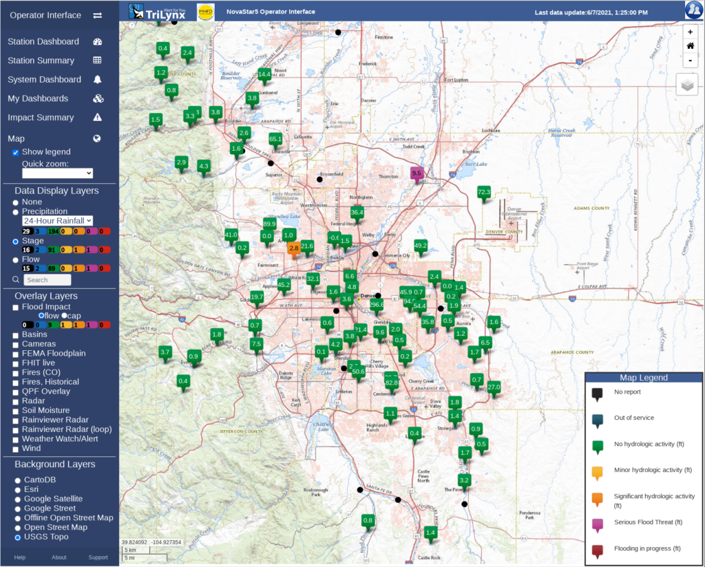
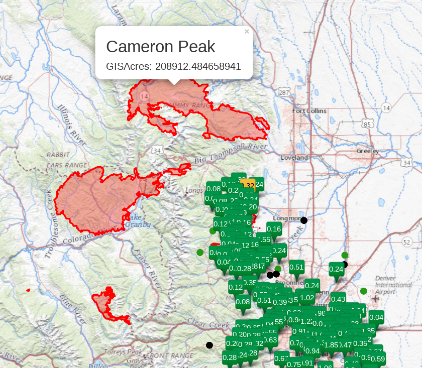
Each station, indicated with markers, reports current and historical environment data at its precise location. The marker color indicates the current status at each location, from no significant hydrologic activity to flooding in progress. Additionally, markers will flash for stations with active alarms.
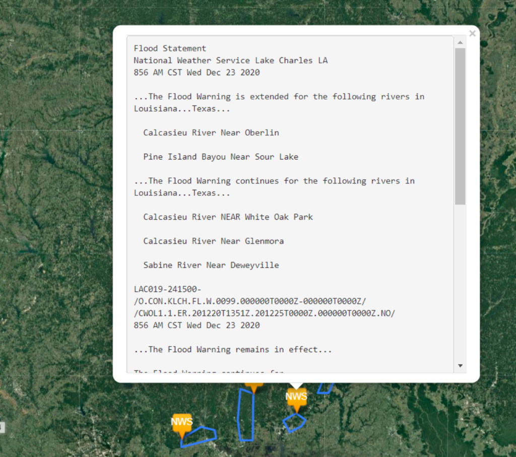
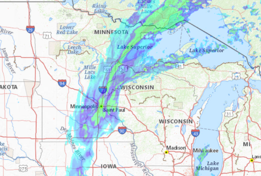
Operator provides a variety of additional map layers such as radar, current and historical fire boundaries, basin boundaries, National Weather Service Watches and Warnings, and photos from live cameras at the site, increasing situational awareness.
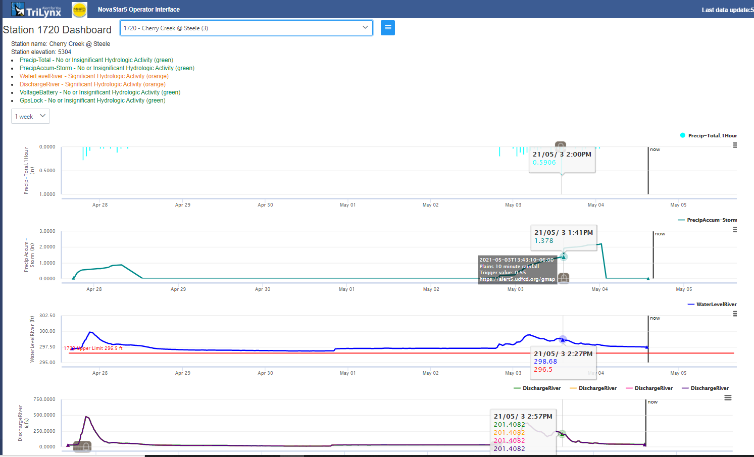
Clicking on a station’s marker displays its dashboard which presents real-time data and historical trends in an adjustable time frame. This data may include precipitation, stage, flow, wind speed, water quality, soil moisture content, battery levels, and more. Above, alarm levels have been set for the water level at this station, which will alert emergency managers or anyone subscribed to notifications of active flooding and danger.
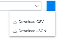
Data can be easily downloaded in CSV or JSON format file for any selected time frame.
Due to its intuitive display and variety of environmental data, Operator is a useful tool for any stakeholder in the monitoring, researching, or emergency management community.